Sticking a probe in the ground or drawing a sample from a river may be the most accurate route to determining water health in a given location at a particular point in time. But when it comes to understanding trends across a broad body of water, a farming region or even an ocean or continent, nothing comes close to the pictures that satellite imagery can paint. And how those images change over time is a particularly powerful tool when it comes to communicating our water challenges to the decision makers charged with making the investments needed to address them.
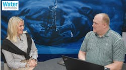
Such was the message delivered by Bianca Pinto, biological systems engineer for the Water Environment Federation (pictured), and Gurjot Kohli, civil engineer with engineering and environmental consulting firm Stantec, in their Innovation Theater presentation to WEFTEC 2024 attendees this week in New Orleans.
“When Gurjot and I met earlier this year at a NASA meeting [on remote sensing], we both realized the power that satellite data brings to the water sector,” explained Pinto. “And we wanted to make sure to share that with all of you because while we do think that there's a value in looking at things at a local level, it’s also important to look at things across a region in a systemic way.”
“It’s the idea of adding another tool to your toolset,” Pinto continued. She noted that NASA has been working on such problems and trying to address them for the past 50 years. And while NASA works on a global scale, they're also trying to work with end users of satellite data to add a regional perspective.
Pinto and Kohli proceeded to outline some of the key satellite data offerings that are of particular utility to water managers—and which for the most part are free to access over the internet.
First up is SWOT, for Surface Water & Ocean Topography. SWOT was launched in December 2022 with the goal of providing a global inventory of terrestrial water bodies, measuring global storage change (depth/volume) in freshwater bodies, and estimating global change in river discharge. Its focus is on lakes, reservoirs and wetlands of 15 or more acres and rivers 100m or wider, with a spatial resolution of 1m in the ocean and 50m on land. Some 40 early adopters around the world include Stantec, the Cleveland Water Alliance, ESRI and the University of Alabama.
Up second is PACE, for Plank, Aerosol, Cloud and Ocean Ecosystem. This initiative has been gathering data only since February 2024 and provides data records every two days on ocean ecology and global biogeochemistry. Applications include water quality, human health, fisheries management, ecological forecasting, disaster impacts and air quality.
“The wavelength of radiation reflected from the ocean informs us about the biological and the chemical components of the ocean, and that can help identify harmful algal blooms when they happen,” said Pinto. PACE has also been used to map wetland vegetation in the Chesapeake Bay area and improve understanding of wetland ecosystem health.
GRACE is up third, standing for Gravity Recovery & Climate Experiment. This global survey includes data on groundwater, root zone soil moisture, and surface soil moisture with 13.5-14km resolution in the U.S. “There are a lot of efforts to use atmospheric forcing data to ingest all this information and combine it with what's available with GRACE to segregate the different types of water storage that you have,” noted Kohli.
SMAP, for Soil Moisture Active Passive, is an orbiting observatory that measures the amount of water in surface soil. “It measures moisture in the top two inches of soil everywhere in the world,” Kohli explained. “So, it basically allows you to look at drought management monitoring in real time.”
“I think the main idea that we wanted to convey is that there's a lot of this satellite data available,” concluded Kohli. “The insights it provides could augment your thinking or provide a different perspective.”


